Techie Saturday is meant to be primarily about computers and such but the current disruption of the Polar Vortex makes this topic of the day, and it does have some pretty neat graphics that I want to show you. :) The source article is one of the best explanations of why we have been having some pretty severe cold snaps the last few years. Let’s start out with a quick quote for the article. Just click on the source to see the entire article.
“This pattern looks much more active, [with] more winter type storms and Arctic outbreaks — I think I would attribute it to definitely being a polar vortex disruption, because it is very consistent with what we’ve seen in the past,” Cohen said.
Source: LifeScience
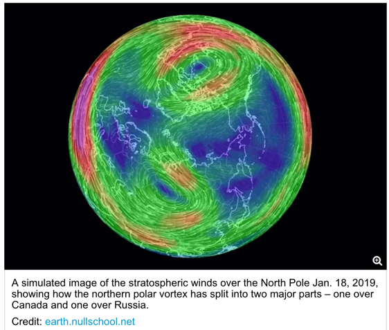
The northern polar vortex is a fast-flowing stream of air that circles the North Pole in the upper parts of the atmosphere, known as the stratosphere, about 20 miles (32 kilometers) above the surface.
A similar polar vortex exists over the South Pole, but it is the northern polar vortex that can bring severe winter weather to the United States and Europe.
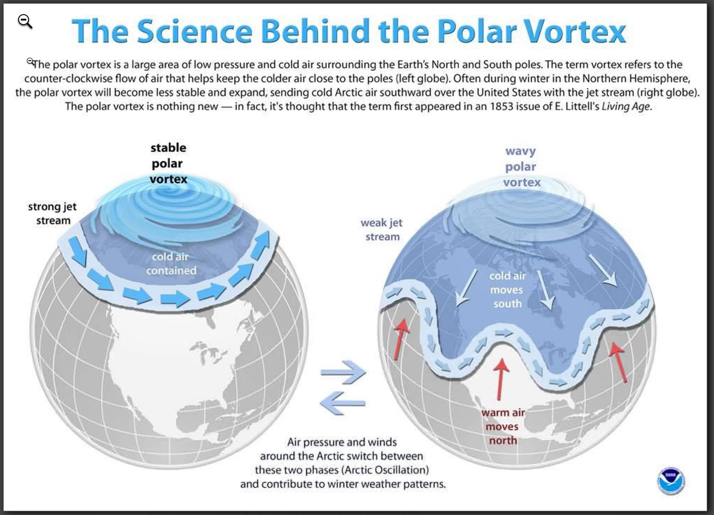
I know there are those who are willfully ignorant on this topic, but I am a scientist so I am definitely not one of them. Up until I read this article I assumed that a polar vortex was the cause of these extreme cold cells moving into my State. I now realize it is the “absence” of a polar vortex that allows the extreme arctic cold to escape. Learn something new every day.
